Move for restoration of Locarno-Milan waterway

Claudio Repossi of Navigli Lombardi reports on a series of events to raise awareness of the historic, cultural and recreational values of the Locarno (Switzerland) to Milan waterway via the river Ticino.

As part of the joint Italian-Swiss project Intrecci sull’acqua – or Dialogue on the Water – a series of initiatives have been launched, including guided tours of the area and pleasure boating on Lago Maggiore (Verbano), along what is known as the ancient ‘Marble Route’.
(supplying marble for the construction of Milan’s cathedral).

Events planned for the weekends of July, August and September were organised thanks to an agreement between the municipalities involved, the Lombardy Region, the Province of Novara and Navigli Lombardi, the last of which has been active for years with its passenger boat service on the Ticino running between Sesto Calende and the Miorina Barrage (and former lock).

Miorina Lock and Dam

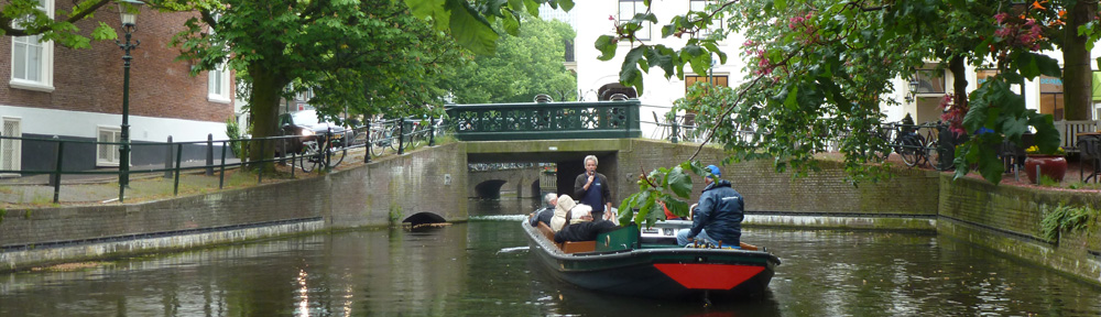
Miorina Lock and Dam on the Ticino River in Lombardy, on the 'Marble Route' (photo © Vito Antongiovanni)

The project includes navigation on the Ticino and on the Lake, partially covering the route taken of old by the barges that carried the precious construction material along the lake-river-canal waterway to Milan.

Today the former waterway is no longer navigable throughout, but great efforts are being made, at a time of crisis in public finances, to reopen it. Miorina lock on the Ticino has recently been restored to working order, and the Panperduto dam, machine hall and adjacent lock are also being rehabilitated. Begun in 2011, the works are financed by Lombardy Region, Consorzio Villoresi, Navigli Lombardi and the electricity utility ENEL, and are to be completed in 2013. Piedmont Region for its part is gathering the funds necessary for the restoration of the Porto della Torre barrage.

Once the works to restore the hydraulic structures on the Ticino are finished, it will be possible to navigate from Lago Maggiore to the start of the Industrial Canal, with four locks to restore as the last obstacle before the final link-up with the Naviglio Grande and Milan.  The Naviglio Grande is already navigable from Turbigo to Cuggiono, albeit with some size limits.

With Expo 2015 in view, an accord for an integrated plan for maintenance of the infrastructure of Milan’s canals and for the valorization of the Navigli and Lombardy waterways as an asset to tourism, the environment and culture, was promoted in May this year by the Lombardy Region, Consorzio Villoresi and Navigli Lombardi. Also involved are the Park management bodies for the Adda Nord Park, the Ticino Park, and the South Milan Agricultural Park. The programme, requiring an investment of around €20million for works to be carried out by June 2015, proposes substantial repairs to the banks of the Naviglio Grande and Naviglio Martesana. It has among its primary objectives the promotion of a Leonardo da Vinci cultural tourism trail along the Lombardy waterways where he experimented successfully with some of the most brilliant hydraulic inventions: the lock flight, the Da Vinci lock and its characteristic stepped upper sill. It also aims to promote the ‘Feed the Planet’ programme, principal theme of the 2015 Milan Expo.

Kindly translated by Maggie Armstrong, ‘Spigolizzi’

Panperduto dam

Panperduto dam and Villoresi hydropower plant on the Ticino, with one of the lock-gate winding capstans in the foreground (photo © Zilvana)

‘Regatta’ promotes Serb canals

Radomir  Ječinac  reports from Belgrade, Serbia, on the ‘regatta’ (flotilla cruise) organised on the canals and waterways of Serbia in June/July 2012.

Remember IWI’s annual World Canals Conference held in Serbia, in the beautiful city of Novi Sad on the Danube, in 2009? The host, Vode Vojvodine (Vojvodina waters) is an all-important institution in our country, which was founded to manage the network of artificial canals in this relatively flat province in northern Serbia. When the Irish boat Aquarelle entered Serbia in July of that year (encouraged by WCC co-host Danube Propeller), and Mike and Rosaleen Miller asked for permission to cruise through the Vojvodina canals, this was en eye-opener for Vode Vojvodine, who were encouraged to give official status to what was previously an informal gathering of domestic boaters each year.

VV Regatta Route 2012

Itinerary for the 11-day cruise, including some of the lesser-used canals

The event has since gone from strength to strength, and I joined this year’s regatta, with a full programme to delight Serb boaters for 11 days (see map, left), from June 24 to July 4. This was the 4th to be organized by VV: 10 stages in 11 days over 300km of canals between Novi Sad and Bezdan. Ah, Bezdan! We heave a sigh at every mention of the name, because the entrance lock here from the Danube is still closed. We still had our moneys’ worth, though, since these 300 km represent half of the Vojvoodina network.

Warned that the number of boats had to be limited, the skippers of some 90 motor cruisers and dayboats of all possible types and sizes, 250 people in all, sent their booking forms as soon as the event was announced! Mothers and fathers of families, to say nothing of the Dog‘, as Jerome K. Jerome remarked. There were couples with children who had barely started walking.

Regatta enters the main canal at Novi Sad

Nearly 90 boats enter the main canal at Novi Sad, approaching the first lock on the cruise

Nearly half the  boats came from afar, boat harbours on the Danube or Tisa, for example: from Belgrade, Zemun, Pancevo, Smederevo, Novi Bečej on the Tisa, not afraid of all the extra kilometres and the strong current of the Danube to reach the starting point at Novi Sad. One sizeable boat came from Vukovar, Croatia, thus giving the event its international character.

The regatta’s Commodore was Mirjana Živković, hydrotechnical engineer at VV, petite, a bundle of energy with bright black eyes, tireless and ubiquitous, participating in the regatta herself with her boat and family, ‘to say nothing of the dog’ in this case also! She had to deal with a complex organization: locks, free passage for participating vessels, technical and first aid teams, municipal receptions for participants, refreshments and local cuisine, al fresco meals along the canals, folklore programs, minimum supplies by itinerant merchants, etc.). For us Serbs, with a litre of diesel costing €1.50, and average monthly wages between 300 and 400 euros, the benefits of organised navigation are obvious.

On pages 35 and 36 of the European Waterways Map and Directory (2008 edition) we read of the attraction of this annual regatta for Serbian boaters. IWI can therefore congratulate itself for having contributed in a way to what is now the biggest navigation event in Serbia.

Backi Monostor floating bridge

Backi Monostor floating bridge on one of the little-used canals on the VV system

VV Regatta mooring

The author beside his boat at a quiet mooring in Bezdan

Filling gaps on the river Lot

Impressive progress is being made on the most ambitious waterway restoration project in France, the 270km long river Lot. Although massive hurdles remain to be overcome at the large hydroelectric dams – Fumel, Luzech and Cajarc – the project conceived in 1973 by Christian Bernad, president of the Association Aménagement Vallée du Lot, is moving slowly but surely towards eventual completion.
The above map shows the downstream section of the river, from the confluence with the Garonne through to the département Lot and its chief town Cahors. This highlights the relatively short missing links. Within the département Lot et Garonne two locks need to be built, one at Saint-Vite and the 8m deep lock beside the dam at Fumel. Above Fumel is the boundary with the département Lot, which was initially content with its 64km navigable section opened in 1991. Under pressure from local authorities, however, this département committed to opening further lengths of the river, hence the 12km extension upstream (not on this map) and especially the series of 9 locks over a length of nearly 40km between Fumel and Albas.
One of our members has just sent this view of works in progress at one of these locks, Floiras, number 18 on the above map*. As at many locations on the river Lot, the head is exploited by a small hydropower plant, so that the lock is located at some distance from the river bank.

Floiras lock

Restoration work in progress at Floiras lock (by KBW)

When this lock is opened later in 2012, the missing link to the middle section of the Lot at Luzech will be only 7km long, including the large-scale works at Luzech itself (probably requiring a new tunnel) and the 3.70m deep lock at Albas.
For details of French waterways and projects throughout the network, see my guide Inland Waterways of France, published by Imray.

Let us know what you think about the River Lot Restoration project!

* The idea of numbering the locks, from 1 (Nicole) to 57 (Marcenac) was put forward in a planning study completed by the author in 1992, to give a sense of unity among the projects implemented piecemeal along the different sections of the river. This idea has not been taken up to date, one reason being that the projects for the missing links remain to be confirmed in terms of technical, financial and economic feasibility.

The featured image (click on title of post if necessary, to see it) has been amended to take into account the elimination of Escambous lock; the hypothetical total is therefore 57 and not 58 locks as originally posted. Click on the image below for an overview of the upstream section.

Navigable river Lot upstream

Status of navigable river Lot - upstream section - from Cahors to Port d'Agrès